Durban, South Africa

A beach city with tropical weather, known for its mix of African and Indian culture, and a surf center – welcome to Durban. It is the third largest city in South Africa and pretty laid back with cafes and restaurants everywhere.

As part of the KwaZulu-Natal region, it includes land of the Zulu people ruled by King Shaka in the early 1800s. I saw part of a traditional Zulu dance and had some traditional food, including cow feet and samp, a boiled corn dish that reminded me of hominy.

Indians were brought to work in sugarcane fields and on railways as indentured servants for the Dutch colonists. A famous South African dish is called bunny chow – curry in a hollowed out loaf of bread. I enjoyed an upscale version with three types of curries.

The city is full of places to hang out and enjoy the relaxed atmosphere.

Okovango Delta, Botswana

In the middle of Botswana, the Okovango delta forms where several rivers meet. The waters of this inland delta never reach the ocean though. Rains arrive in Angola and Zimbabwe in January and February and flow south. By June the delta is flooded by 11 trillion liters of water. Right now it is very dry, even though it is the rainy season here; the landscape will look completely different in the flood season.

I went on day safaris, driving around, walking inside the delta, and boating on the water in a mokoro (like a canoe but moved with a pole). Amazing wildlife and big sky landscapes!

Red lechwe antelope are unique to the area and eat aquatic vegetation.

Bored hippo

Kudu male antelope

Buffalo – the males have thick horns across the forehead for fighting while the females have thinner plates.

Hornbill – I think I’ve seen all the main Lion King characters now!

Giraffe and zebra are often found together, along with wildebeests, because they eat different food – so no competition- and can sense predators differently so they protect one another.

Saddle billed crane

Majestic baobab tree

Reed frog – about 2 inches long

Exploring the delta in a mokoro

Kingdom of Swaziland (now renamed eSwatini)

Swaziland is a very small country (120 miles by 80 miles) of about 1 million people. Located between South Africa and Moazambique, it is the only country still ruled by a king with absolute power.

People are friendly, the country has been stable for over 100 years, and there is spectacular scenery and wildlife. But 27% of the population is infected with HIV; the highest rate in the world. The government, CDC, and others are working to treat people and stabilize the epidemic but it is a massive problem and has drastically reduced life expectancy here.

The majority of people are subsistence farmers but there are some larger towns. I didn’t see much of them however as I wanted to see the national parks.

Mlilwane Wildlife Sanctuary is in the foothills and animals and people roam freely because there are no predators. So visitors can walk and bike anywhere and get very close to the animals, like this zebra herd that completely ignored me.

Warthogs and nyala antelope wandered around the campsite. I stayed in one of these traditional beehive huts. Just had to duck a little to enter and there aren’t any windows but it was very comfortable.

Another type of antelope, a blesbok.

Then I visited Hlane Royal Park, it once was the king’s hunting grounds but is now a conservation area. I went on two drive safaris – no walking around alone like at Mlilwane – here’s why!

On the rhino drive, we were able to get out and with the guide, approach the rhinos to see them better! A mother and 4-year old daughter were resting in the shade. The mother was sharpening her horn on the trees – not as a threat to the humans but because this is the horn-sharpening area.

Also saw elephants. This female thought we were too close and started to warn us off until we got far enough away. They are big animals!

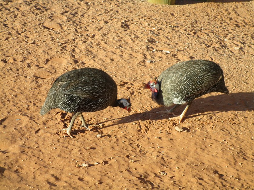
Also saw a brown snake eagle,a starling with red eyes, and juvenile male nyalas.

The Garden Coast, South Africa

South Africa’s south-western coast is a popular holiday destination. Various green ecosystems are found here, from jungle to fynbos to farmland along with bays and wetlands – so it’s called the Garden Coast.

The main (usually 2 lane) highway goes along the water through several small and mid-size towns and many farms. It’s autumn here so not as green as in the busy season.

Mossel Bay is a beach town surrounded by an industrial area and poor townships. This is where the first Europeans landed in South Africa in the search for a route to the Indies. The local museum has a replica of the ship used.

Condos and hotels line the rocky shoreline. There is some surfing but not much swimming because of the strong currents and jagged rocks so it’s not exactly like U.S. beach towns, though there are ice cream stands and a boardwalk.

Wilderness is a very small town around a wetland and surrounded by a nature reserve.

Knysna (pronounced nys-nah) is on a big bay and estuary. Towering rocks guard the narrow entrance and while there is no commercial ship traffic, tour and sail boats are everywhere. There was a huge fire here a year ago with homes burnt and parks destroyed but they are rebuilding and recovering.

As for South African cuisine, there is a lot of fish, shellfish, and calamari served along the coast. Then there are the traditional foods like biltong – basically meat jerky – but made of beef or game animals. It’s so popular there are stores just for various types of biltong. Bobotie is a baked dish of egg and minced beef served with rice, chutney, and coconut cream.

And a final photo of the coast!

Cape Town, South Africa

Cape Town had a lot to live up to – I’ve heard people rave about it for years and now I can say they were absolutely right! It’s a growing and changing city with a cosmopolitan downtown and tranquil wineries and parks on the outskirts. The backdrops are spectacular as Table Mountain towers above and the ocean surrounds it on three sides.

The downtown and waterfront fill with people, restaurants, and shops. The dining options include global cuisines and local artisans.

The Constantia winery region is on the other side of Table Mountain. Pinotage or Chenin Blanc anyone?

Cape Point Park includes the Cape of Good Hope with spectacular views and many shipwrecks. It’s not the southernmost point but it is the most famous one.

I saw elands, baboons, dassies, and ostriches there. Seeing ostriches by the ocean was odd,

but then I saw penguins in trees and shrubs! Boulders Bay has a colony of endangered African penguins right inside the town.

The city is filled with history and stories. I’ll have a separate post with what I learned about the apartheid era during my tours of the city, Robben Island, and District Six.

Right now Cape Town and the cape area has a multi-year drought going on. It is so bad that they were expecting “Day Zero” to happen in April – the day the water sources were empty and they would have to turn off the water to the entire city. But that day has moved back and may not happen this year due to severe water restrictions and conservation efforts.

Taps almost everywhere are turned off and antiseptic sprays used instead. The goal is for each person to use no more than 50 liters (13 gallons) a day for everything. The place I stayed had a plastic tub to collect the shower water and then that water was used to flush the toilets. The conservation efforts are strict but seem to be working. Now they need the rains to come to keep it from getting worse.

Swakopmund and Windhoek, Namibia

Swakopmund sits among the sand dunes on the Atlantic coast. It was a former German colony so the architecture is reminiscent of Bavaria. It’s a popular vacation spot so there are cafes and restaurants and plenty of things to do.

Just a short drive south is Walvis Bay, Namibia’s only port. We took a harbor cruise to see the colonies of cape fur seals.

Some of the seals and great white pelicans even visited us on the catamaran.

Windhoek is the capital of Namibia with about 350,000 people. Its landmarks include the Independence Memorial Museum and a gingerbread style church from 1910.

The city is on a plateau over 5,500 feet high so it is cooler than the rest of the country. And though it is the driest sub-Saharan country, it is the rainy season and there have been rainstorms most days.

Namib Desert, Namibia

Photos of this desert made me want to travel to Namibia and the scenery is truly gorgeous here! The country is about the size of France but with a population of under 3 million so it is one of the least densely populated places in the world. They became independent from South Africa in 1990. It is very dry here with most of the land consisting of desert or scrubland.

The Namib desert runs along the coast for 1,243 miles and is one of the driest places on Earth. The dunes are 65 million years old and at sunrise, the colors and shadows are striking.

As part of the Namib desert, the Deadvlei (Dead Valley) is a salt and clay pan that was once an ancient sea bed. It didn’t look like much when we were hiking to it – and had C. wondering if I was crazy to drag us out here –

But once on the salt pan and in the early morning hours, the colors were constantly changing based on the angle of the sun and the dramatic colors appeared. These photos aren’t photoshopped and were taken within minutes of each other. Really spectacular!

The red color is from iron in the sand oxidizing and creates rust colors that are really vibrant in the morning sun.

The trees are 700 to 1,000 years old! It is so dry here they don’t decompose and the dunes protect them from the wind. But the heat from the sun, which reaches over 100 degrees, has scorched them black.

We also saw oryx and ostriches in the desert and at our hotel near the park, the oryx and guinea fowl (African chickens) came to snack on the landscaping.

Victoria Falls, Zambia and Zimbabwe

The coveted double rainbow photo of Victoria Falls! Since it’s the rainy season most of the view sites are covered in mist and rain but the sun came out for a few hours for some spectacular views.

C. flew out from D.C. and we spent several days in Zambia and in Zimbabwe visiting the falls. We chose an adrenaline tour and went with a guide to Angel’s Pool. It is at the top of the falls and only 5 feet away from the edge to the rocks 300 feet below!!! It was crazy but fun!

Here are a few views from the top of the falls, from the Zambian side, and from the Zimbabwean side. The gorge forms part of the border between the two countries. The falls are the longest in the world at 5,604 feet wide and up to 100 million gallons a minute flow over the edge. The river is brown from all the soil runoff from the rains so the falls look striped!

The falls are called Mosi-oa-Tunya or The Smoke That Thunders because it looks like this from a distance. That’s the mist from the falls hitting rocks over 300 feet below!

Zanzibar, Tanzania

The Spice Island! White beaches, blue waters, and a historical center called Stone Town. Zanzibar is only a 2-hour ferry ride from the big city of Dar es Salaam and is part of Tanzania. It has been ruled by the Portuguese, then by Oman until the 1960s when it joined with the mainland.

Tanganyika (mainland) + Zanzibar = Tanzania

The old town is known for its maze of small streets and big, carved, wooden doors. The island was an important port for East Africa and was a center of the slave trade for hundreds of years.

It is known for its spices and there are farms to visit and see what the plants look like. Pepper and vanilla plants below.

And as a result of all the readily available spices the food is very good. Curries with spiced pilau rice, cassava leaves and roots, and pumpkin.

I saw a cooking demo too where the cassava leaves are pounded until they are soft enough to cook like greens.

Some scenes from Stone Town – the beaches get busy once the sun starts to set and it cools off. Many fruits are grown here so juice shops are all over.

And a Safari in Tanzania!

Scattered across the Ndutu plain in Tanzania are 1.3 million wildebeests and 250,000 zebras. They migrate here in February and March to eat the grass on the Serengeti. They’ll give birth and then head north following the rains. It’s hard to tell the scale but we drove for many hours past endless grasslands covered by herds. The Serengeti ecosystem includes the Masai Mara park in Kenya but the area in Tanzania is much, much larger with multiple parks and conservation areas over 5,700 square miles.

Baby zebras have brown stripes so they can hide in the grass.

Black rhinos are critically endangered with only about 5,000 in the world. In Tanzania, each one has a tracking device implanted in their horns and they are monitored by satellite.

We saw two groups of cheetahs sunning on termite mounds. Sadly, only 5% of cubs survive to adulthood. They wandered off when our amazed staring became too much!

The Ngorongoro crater area next to the Serengeti was formed by volcanos. The park is monitored by satellite and rangers and strictly regulated. There are many resident animals here year-round and when the rains come, a lake forms on the valley floor and more animals arrive. There are some permanent water holes for the hippos too!

And probably my favorite photo. In Kenya I vainly searched a tree where a leopard had been spotted but never saw it. In Tanzania, I finally saw one with the binoculars and then used a trick another woman showed me to take a photo with my cell through the binos. See it hiding on the left? (Look for the tail hanging down.)

More photos of animals! A just born wildebeest, warthog family, elephant herd, curious zebra, impalas, giraffes, male lion, and a jackal.